Just a short time after our last visit my son, Scott and I drove down to Devon again ready for our 18th trip walking along the South West Coast Path. We stayed in a Premier Inn in Exeter and it was the usual comfortable, no frills hotel room, perfect for our first night. No great adventures tonight, just a pizza from the Domino’s across the street and an early night ready for resuming the walk the next day.
TORCROSS TO DARTMOUTH 10.3 MILES
We were up early and drove the car to Kingswear where we found a parking space and caught the ferry across the River Dart to Dartmouth. We went on the car ferry which is a strange raft like thing pushed along by a tug! There is a more comfortable passenger ferry as well if you don’t want to be squashed in amongst the cars. We then got a number 3 bus to Torcross (which is where we finished our walk in Visit 17). Thank god for the OAP bus pass, it cost Scott £7 for a 30 minute journey! I was pleased to be back in Torcross. aAs I mentioned before there are lots of memorials and history here re the training of Americans for the D Day landings and the evacuation of half the village to accommodate them. This place is well worth a visit as it also has Slapton Sands (or The Line as it is known locally) and Slapton Ley. Slapton Ley is Devon’s largest natural freshwater lake and is a national nature reserve, home to hundreds of rare plants and birds. We started the walk along this route and I have to say, the Council need to get those strimmer’s out! On some of the path, the flowers and grass were over my head! (Not very helpful for my hay fever! Scott, being ahead, couldn’t see me in the foliage behind him but luckily he knew I was still there from my constant sniffing and sneezing!)
We walked through the village of Slapton (recorded in the Domesday Book in 1086) and onwards to Strete Gate where the road veered away from the coast and headed upwards. The name, Strete Gate, refers to the time when The Line was used for grazing and a fence and gate were constructed at the North end of the sands to control the animals. From Strete Gate we followed what was an old coach road but is now a pleasant traffic free lane. After passing through Strete Village the Path headed off on our right across fields and back towards the sea. (Lots of the fields had cows in them, only we couldn’t help noticing that they didn’t have udders! It is always more nerve racking walking through a field of bullocks!) The Path then went steeply down to a footbridge in the Landcombe Valley before ascending straight up the other side to cross over the A379. We then came across the lovely Blackpool Sands (with no Tower or Ballroom in sight!). This is an award winning beautiful Blue Flag beach. There is supposedly a very good café here but we didn’t stop. We headed off through the woodlands and our next village was Stoke Fleming. We passed the village hall and the petanque area and arrived in Little Dartmouth and Warren Point. Fabulous views from here and the off shore rocks are oddly called The Dancing Beggars. The views encompass Start Point to the right and across the mouth of the Dart river to the cliffs east of Kingswear to the left. During this walk I have fallen in love with the craggy, wild coastline of Cornwall but I think that the views in Devon are as beautiful, albeit less rugged and more calm. The Coast Path then bears East then North passing round the back of Compass Cove (there are lots of wonderfully named coves along this stretch, Shingle Hill Cove, Ladies Cove and Dead Man’s Cove being some of them. ) A zigzag path took us almost to sea level at Sugary Cove and then straight up again. The weather had been fine all day but it now began to rain. We were fairly sheltered by trees until we arrived at Dartmouth Castle. The Castle is very small and was built in the 1480’s to defend the town against sea attacks. The Path then took us into Dartmouth via Bayard’s Cove Castle (a cobbled shell of an Elizabethan fort). The Cove was one of the last stops for the Pilgrim Fathers setting off for America in 1620 and has featured in many TV shows and films such as The Onedin Line. We had now reached Dartmouth and it is a very attractive lively town with an impressive harbour, galleries, cafes and restaurants. Richard the Lionheart and his Crusaders set sail from here as did a number of troops for the D Day invasion of Normandy. The Britannia Royal Naval College is still here and stands impressively overshadowing the town. We got the ferry back to Kingswear and picked up our car. Tonight we stayed at The Florida Guest House in Paignton. Our rooms were not big enough to swing a cat (but luckily we hadn’t thought to bring one with us!) but they were clean and the breakfast was plentiful.
DARTMOUTH – BRIXHAM 10.9 MILES
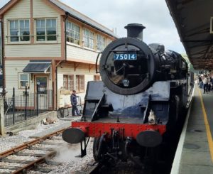
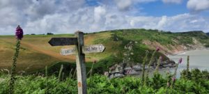
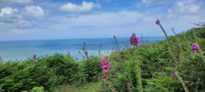
After our plentiful breakfast we left the car near the guest house and walked to Paignton station. We had decided, rather than using expensive and boring buses, we would treat ourselves to a ride on the Dart Valley Steam Railway. It follows the line that was opened in 1864 to Kingswear and the £15 ticket includes a ferry ticket (which we didn’t need that day unfortunately). The station is olde worlde and the staff dress in old fashioned uniforms so it is a lovely experience and any journey on a steam train is always a delight. At Kingswear we began today’s walk and I have to say it was a very tough 10.9 miles. It took us 7 hours as there was a lot of hills to climb and valleys to descend. In the guide books it is called “a challenging and strenuous walk” and I can certainly verify that! The weather was a nice surprise though, the sun came out and it was, with the sea breeze a perfect temperature for walking. So we left the station and headed up Alma Steps and headed along a fairly straight road before taking some timber steps down into the valley. Supposedly there is a plaque here to Lt Col H. Jones, VC, OBE (we couldn’t actually see it however). After his death in the Falklands it was agreed that a new length of Coast Path from Kingswear to Newfoundland Cove should be opened in his memory. It seems he had strong family connections to the area. For the next six miles the coast is described as one of the most beautiful stretches along the entire National Trail and we had to agree as each hill we ascended or descended (and there were a lot of them!) exposed views that were each more beautiful than the last! The first descent was Mill Bay with a small castellated building which used to be a mill. The Path then went up steeply and after one and a half miles walking among the Monterey Pines we came out to view fabulous panoramas and then came to the Froward Point Coast Defence Battery (decommissioned in 1956). There are wonderful views of the Mew Stone (grey seals are supposed to be abundant here but we didn’t spot any. I get so excited when we do see wildlife, we did see a rabbit on this path, it hopped onto the path ahead of us and just sat there for ages, even posing for pictures it seemed!) From Froward Point there are a couple of paths you can take but we chose the official route which went around the concrete bases of the gun stations and past the tracks where the shells were brought down on a small rail cart. We then dropped steeply into Coleton Fishacre Valley and up the other side. (Coleton Fishacre Garden is here and can be visited on Wednesdays, Fridays and Saturdays. It was built in 1925 by Roper D’Oyly Carte, son of the Gilbert and Sullivan impresario). We passed Newfoundland Cove and Sharkham Point. The latter looks down at picturesque St Mary’s Bay and you can see onwards to Berry head. Before this there was a steep descent into Scabbacombe Sands, a delightful cove then up again and down again to Man Sands where we saw an old lime kiln and walked on the shingly beach. There were lots of holiday parks along this stretch until we arrived at the fortifications at Berry Head. Looking at the fortifications meant a detour off the Path and I am not sure it was really worth it as we were very tired by then. I had been lured by the thought of an ice cream in The Old Guardroom but was disappointed to find this closed! There are lots of sea birds nesting on these cliffs but the fortifications were not very interesting. ( By the way Berry means castle or fortification.) We were now heading into Brixham. We passed a lovely old open salt water swimming pool (closed at the moment) and a lovely harbour with restaurants etc. Near here is where the protestant William of Orange landed with 20,000 men on November 5th 1688. He came to oust King James and the occasion is referred to as The Glorious Revolution. His statue stands in the Quay as does a replica of The Golden Hind. Today’s walk was very long and very hard but it was very beautiful and most of the Path was lined with huge foxgloves. We caught a bus back to Paignton and tonight I was quite happy that my room was so tiny, I did not have to get up off the bed to reach anything I needed, it was all within stretching distance and I was therefore able to rest my tired feet!
BRIXHAM – TORQUAY 8.5 MILES
After another plentiful breakfast we packed up and drove to Torquay. After parking the car in a shopping centre for an exorbitant fee we then got the number 12 bus to Brixham. Our walk today was so much easier than yesterday. The hustle and bustle of Brixham Harbour was soon left behind us and a lot of the walk was through woodland. There were a couple of climbs but mainly it was easy walking. However, as we were leaving Brixham Harbour I was ecstatic to see “Bob”. (Well we think it was Bob, he is a seal that I saw on the Devon and Cornwall TV programme and is always hanging around the fishing boats for scraps). It was lovely to see him and he actually swam along the Path for a little way so we had him in sight for some 30 minutes. We could now see Devon’s famous red sandstone cliffs and we passed Fishcombe Cove (where William of Orange actually landed) and Churston Cove. There were lots of colourful beach huts along this route all the way into Torquay. Eldberry Cove was particularly picturesque with a small ruined bathing and boating station which had belonged to the Buller family of Lupton House. Broadsands was the next stunning beach, the steam train runs alongside the beach and the Path follows the train tracks and goes under railway arches when necessary. We stopped for an ice cream in Goodrington which is a bit more commercialised than the other bays with an enormous leisure centre. Needing to spend a penny, I was a bit shocked to see that all the public toilets along this route cost 30p to enter and payable by card only! What is that about? We were then trying to follow a trail of acorns set into the pavement from here into Torquay but these are hard to spot (we saw only 4!) but the Path curved up to Cliff Road and from there we followed the path through Paignton and on into Torquay. Retrieving the car we headed back to London. Almost another 30 miles done so only about 133 miles still to go. I think Scott wants to get it done before I deteriorate any more ( I am getting noticeably slower I have noticed) so we are back down again in a weeks time. More then..


