Pont Du Gard is possibly one of the most famous and most visited visitor attraction in the south of France with well over a million visitors a year.
In the 1st century AD, Nîmes was a prosperous Roman colony with a growing population. The water supply for the city couldn’t cope and a new source of water was needed. This was found at Uzès, about 20km to the north of Nîmes. Because of the difficulty of the terrain, a 50km aqueduct was needed to cross the Gardon valley.
The drop from the source at at Uzès to Nîmes was 17m with an average gradient of 34cm/km and it took the water just 27 hours to reach Nîmes. This followed a mainly underground route until the crossing of the River Gardon. Here a massive aqueduct was needed. Pont du Gard is regarded as one of the masterpieces of Roman engineering as well as the being the biggest Roman aqueduct to be built.
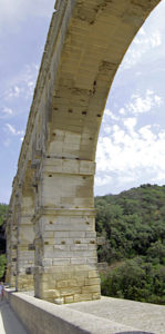
The actual date of construction is unknown but thought to be in the early years of the first century. It is estimated that it took about five years to build using between 800-1000 slave labourers. It was built without the use of mortar with the stone blocks being accurately cut to size. The stones were brought to the site by barge and a wooden scaffold was used to build the arches. The holes and protruding stones for the wooden framework can still be seen.
It is an amazing structure with three tiers of arches. There is a lower row of six massive arches that are 22m high. The middle row has eleven arches which are 20m tall. At the top are 35 small arches with a height of 7m. The enclosed water channel ran along the top of these. The width of the aqueduct varies from 9m at bottom to 3m at top. It is 274m long and the total drop over the length is only 2.5 cm, just enough to ensure a flow of water.
The aqueduct continued in use after the fall of Rome until the C6th when increasing build up of calcareous deposits in the water channel eventually clogged up the flow of water. It continued to serve as a bridge for local traffic. In the C13th, the French king granted the feudal lords of Uzes the right to charge tolls from those who used the bridge which would be used to maintain the bridge.
Army artillery crossing during the Wars of Religion in the C16th had damaged the bridge structure and the base was extended in the C18th to provide a new road. This continued to be used until 1996, with visitors cars and tourist coaches crossing the bridge.
By then there were increasing concerns about damage caused not only to the bridge but also the surrounding area by the number of visitors. An extensive management plan was drawn up to redevelop and conserve the area with a large off site car park, information centre, shops, cafe and museum. Carefully constructed footpaths lead to the bridge and pedestrian access is still allowed across the lower bridge and this is the only way to get between the two sides of the valley. There is access to the top of the bridge on both sides of the valley, but not across it, unless you are booked on a guided tour of the top of the bridge.
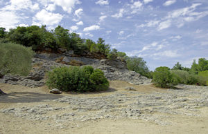
The museum is very modern with multi media presentations covering the history of the viaduct, its construction and the importance of water, not only for drinking but also for baths and fountains. The surrounding countryside has been restored and there is a 1.4km trail through a typical scrubby Garrigue landscape with vineyards, grain fields, olive trees, mulberry trees, holly oaks and fruit trees.
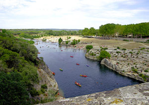
The river with its coarse sandy banks is popular with holiday makers and canoeists.
The site does get very busy with tourists, particularly around the information centre and shop. It is a short walk to the viaduct.
I visited here on Day 6 of Burgundy, the River Rhone and Provence, a river cruise with Riviera Travel.
My full account with all the pictures can be found “here.”:http://wasleys.org.uk/eleanor/otherholidays/rhone/index.html here.


