Owston Ferry is a small village on the west bank of the River Trent, about ten miles north of “Gainsborough”:https://www.silvertraveladvisor.com/review/place/146499-review-gainsborough .
As its name implies, Owston ferry has been an important crossing point on the River Trent since ancient times. Before good roads and rail links, the river was also an important trade route between Gainsborough and Hull.
It was originally two settlements, Owston (from the old Norse for east farmstead) on the higher ground to the west of the Trent where the church is, and West Kinnard’s Ferry on the river bank. This was a corruption of King Edward, who granted a market charter and annual fair in the C14th. It wasn’t called Owston Ferry until around 1900.
A motte and bailey castle was built after the Norman Conquest to control river traffic. This may have been built on the site of a Roman Castrum, as a hoard of Roman coins was found near the site.
A church was built in the inner bailey of the castle. Both castle and church were built of wood and nothing remains of them, although the motte can be glimpsed through the trees to the south of the church.
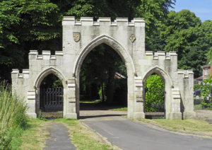
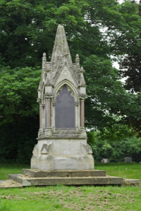
The present “church”:http://wasleys.org.uk/eleanor/churches/england/lincolnshire/lincolnshire_three/owston_ferry/index.html dates from the late C13th and was restored in the C19th. It is at the western end of the village and reached through a splendid C19th ceremonial archway and wooded driveway. In front of the church is the village war memorial.
It is an attractive building surrounded by the old graveyard and still has the pre-reformation stone altar in the south chapel.
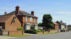
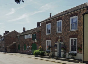
By the C19th Owston Ferry was a very important and thriving local centre with a population of around 1,600. There were thirty shops and brewery, ropery, boat builders, gas works, brick and tile yard, corn mills and sail cloth manufacturers. Many of the buildings along High Street date from then. The houses were designed to cope with flood water from the river. The front door opened into the parlour and there were steps down into the kitchen and scullery. If both front and back doors were opened, the flood water would rush through the house. The row of six almshouses were built in the 1860s.
The ferry finished working in the 1940s and there is now nothing to see of the ferry landing next to the White Hart public house.
Mains water didn’t arrive in the village until 1935 and electricity in 1939. It still doesn’t have a piped natural gas supply.
The industry and most of the shops have gone. The Market Place, with the Millennium Clock and red phone box survives but there is no longer a market. The old school with separate doors for boys and girls, is now a private house, and there is now a new primary school on the edge of the village.
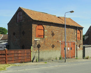
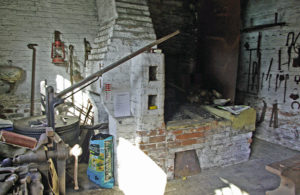
The “Smithy”:http://wasleys.org.uk/eleanor/presocialhistory/socialhistory/industrial/owston_smithy/index.html stopped working in 1975 when the last owner retired and shut the door, leaving everything in situ.
This has since been restored as a heritage centre with the two forges on the ground floor. The yard and sheds contain a variety of agricultural equipment donated by locals. The upper two rooms contain a collection of old photographs and artefacts from the area.
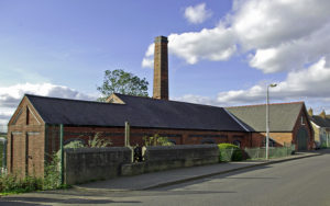
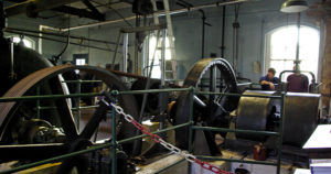
The Isle of Axholme used to flood regularly and a series of pumping stations were built along the banks of the River Trent in the C19th to improve drainage. A small “pumping station”:http://wasleys.org.uk/eleanor/presocialhistory/socialhistory/industrial/owston_pumping/index.html was built to the south of the village in 1910 powered by two steam boilers. These were later replaced by larger and more powerful diesel engines.
When the pumping station became redundant a few years ago, it was leased to the Owston Ferry Pumping Engine Preservation Society to preserve it as an example of a once familiar part of the landscape. It is open a few days each year and is a fascinating place to visit.
This part of Lincolnshire, the Isle of Axholme, gets few visitors. It is an attractive drive down the west bank of the Trent through a series of small villages that have been left behind by time. There is a lot of history here as the remains of the medieval open field system, with its long strips, can still be seen around the neighbouring villages of Haxey, Epworth and Belton.
Epworth, four miles away was the “childhoof home “:http://wasleys.org.uk/eleanor/stately_homes_castles/england/eastmidlands/epworth/index.html of John Wesley.
