

This is probably one of the nicest and easiest low level walks in the Lake District. There is a good footpath all the way round the lake and it is best walked anticlockwise for the views. The path runs just above the level of the lake through a mix of open woodland and open pastureland. There is a short stretch along the road at the far end as well as a short stretch through a tunnel cut through the cliff face. The permissive path along the northern end of the lake is closed from April to June as sandpipers nest along the shore here.
The “walk”:https://nt.global.ssl.fastly.net/buttermere-valley/documents/download-a-simple-map-for-the-round-the-lake-walk.pdf is about four and a half miles and takes two and a half to three hours.
Buttermere is one of the smaller and more isolated lakes and gets fewer visitors. No motor boats are allowed on the lake and there is no boat hire either. Buttermere is a tiny hamlet set in a U shaped glaciated valley between Lake Buttermere and Crummock Water. It is surrounded by the peaks of Red Pike, High Stile, High Crag, Fleetwith Pike, and haystacks.
There are two possible suggestions for the name. One, it comes from the old English meaning the lake by the dairy pastures as this was once important cattle country. The second is that it comes from the Norse name Buther. Large numbers of Vikings settled on Cumbria during the C9th and C10th and Buther was an C11th Norse chieftain holding land in the area and waged a a campaign against the Norman invaders.
Buttermere village has two pubs, a tea room and a few houses. The old village school is now the village hall. St James’s Church to the east of the village has a memorial to Alfred Wainwright.
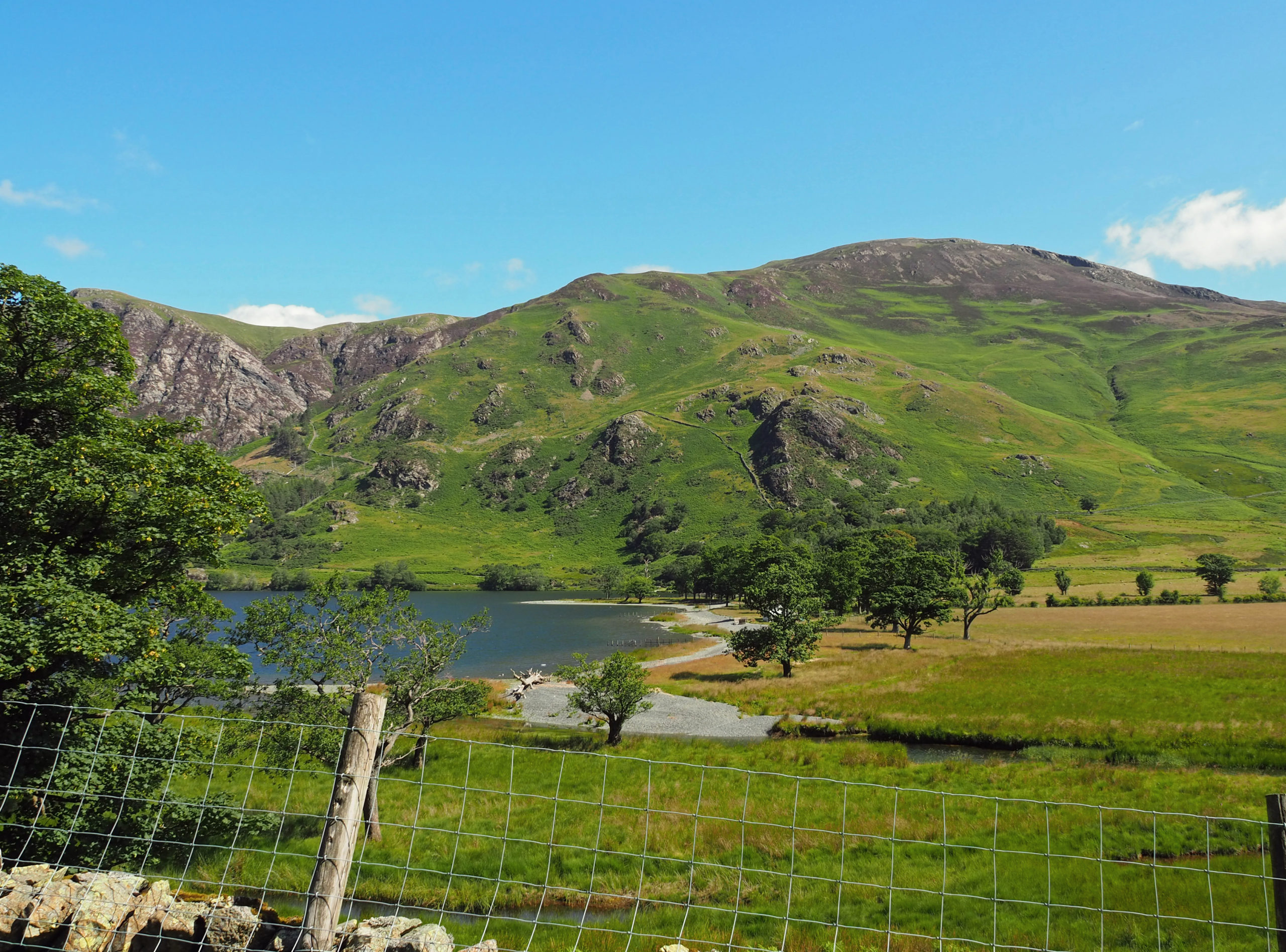
The walk starts from the village and heads across to the northern end of the lake, crossing Buttermere Dubs which drains water from Buttermere into Crummock Water.
The path now follows the eastern side of the lake, through the mixed deciduous woodland of Burtness Wood. There are views across the lake to Dalegarth and back towards Buttermere. Above the shore, slopes are rugged with grazing only for sheep. There is a lot of bracken and burns tumble down the hillside
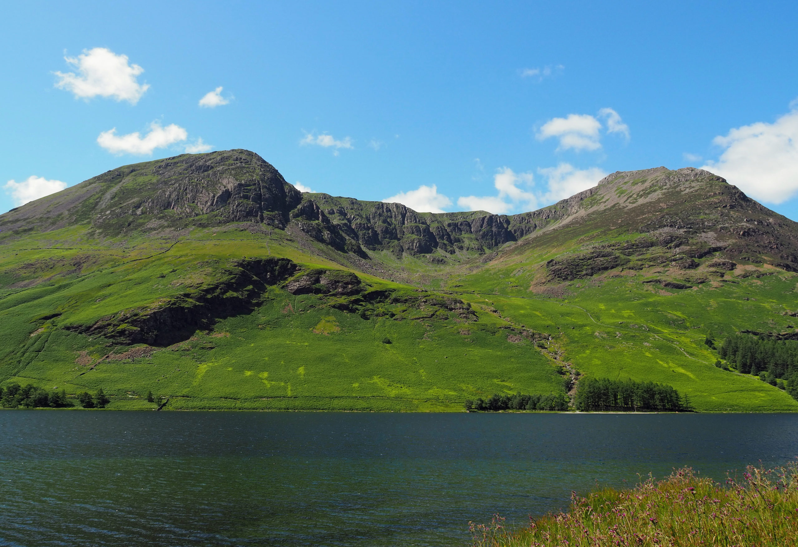
The path crosses a small burn at Peggy’s Bridge and runs across the southern end of the Lake to Gatesgarth Farm. This makes its own ice cream which is sold from a small kiosk by the farm.
There are views up to the U shaped valley at the head of the lake.
The walk now follows the road for a short distance until a footpath branches off to the lake. There are views across the lake to a hanging valley, with a waterfall tumbling down from it.
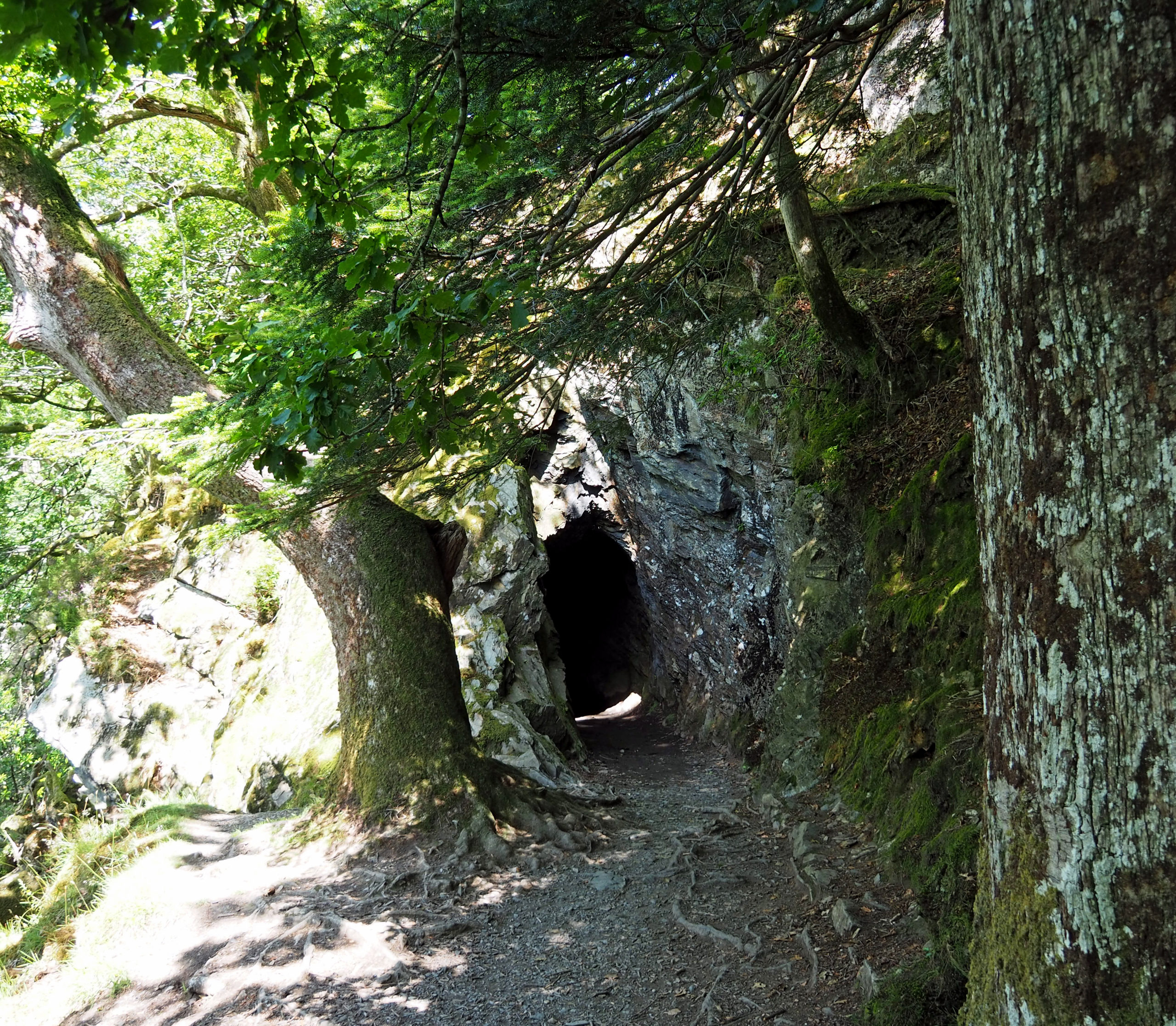
The path follows the side of the lake apart from a short tunnel cut through the crag face just beyond Crag wood. The path continues along the shore of the lake and returns along the north shore to Buttermere. Back in the village, “Croft House Farm Cafe”:https://www.silvertraveladvisor.com/travel-product/place/209535-croft-house-farm-cafe does very good cakes and ice cream!
There are a lot more pictures “here.”:https://www.sloweurope.com/community/threads/a-walk-around-buttermere-cumbria.6019/